How Fog Harvesting Works: Could Britain Collect Water from Mist?
Fog nets can pull drinking water out of thin air, but does damp Britain have anything to gain? How the...

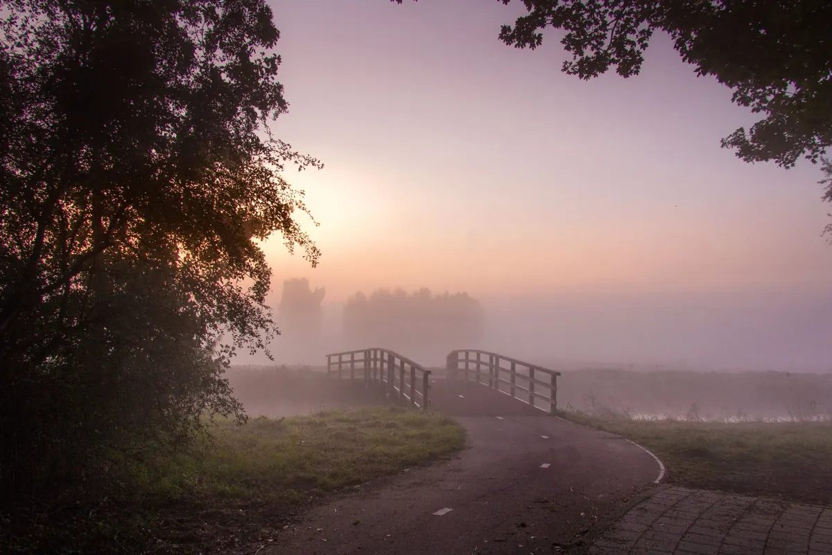
Half past six, and the road ahead of you has vanished. Not all at once — fog rarely does anything all at once — but in stripes. Clear past the garden centre, thick as milk at the bottom of the dip, gone again by the roundabout. You slow, you squint, you wonder whether the car behind has noticed.
Reading fog before you set off is a genuinely learnable skill, and it comes down to three questions: is it there, where will it sit, and how will it change while you're driving?
Radiation fog is the classic. On a clear, still night the ground loses heat quickly, the air just above it cools, and once it reaches its dew point the moisture condenses into droplets. Nothing has drifted in from elsewhere; the fog has formed where you're standing. It builds in the small hours, thickens towards dawn and is usually at its worst just before sunrise.
Valley mist has drained into place. Cold air is denser than mild air, so on a calm night it slides downhill, following fields and lanes, and pools wherever the land dips: river valleys, canal sides, hollows, the bottom of a long hill. A ridge can be perfectly clear while the valley below it is opaque.
A third type, advection fog, forms when mild, moist air drifts over a cold surface such as the sea. It doesn't wait for dawn and can settle in for days, but for a commute it's radiation fog and valley mist that you'll meet most often.
Radiation fog needs a clear sky, a light breeze rather than a strong one, and a long, cool night. Cloud acts like a blanket and stops the ground cooling; strong wind mixes the air and stops the cooling from concentrating near the surface. A little wind helps, though — it stirs the lowest layer so the fog spreads across the road instead of sitting in one frosty hollow.
The most useful number in any weather app is the gap between the air temperature and the dew point. When that gap closes to a degree or two, you are within touching distance of fog. If your app shows an overnight minimum of 3°C and a dew point of 2°C, expect mist or fog on low ground. If the minimum is 8°C and the dew point is 3°C, you can relax.
Because cold air flows downhill, the fog you meet on the way to work is not random. It collects in the same places most mornings. Before your next journey, run through your route and mark the low points:
Once you know your own hot spots, you can often predict the fog without checking a forecast at all. It's why a local driver lifts off the throttle two hundred yards before the dip.
Fog on the move comes in banks rather than one blanket, thickest in the hollows and thinnest on the rises. You'll often feel the density change within a few hundred yards: a grey thinning at the edges, then a wall again where the air is still and cold.
Watch the temperature display too. If it's sitting near freezing, the fog may be freezing fog, and the droplets can deposit ice on the road, on bridges and on your windscreen. Bridges and overpasses freeze first because cold air reaches them from below as well as above. Treat a foggy morning at or below zero as an icy morning.
A few habits make a real difference:
Radiation fog usually begins to lift within an hour or so of sunrise. Sunlight warms the ground, the air just above it mixes, and the fog thins from the edges and from below, often turning into low grey cloud that hangs about until mid-morning.
There are two other endings. In midwinter, when the sun barely climbs, fog can sit stubbornly all day, particularly in southern England. And if a breeze picks up, the fog may lift into stratus rather than disappear, leaving grey skies and misty hilltops. If fog survives into the afternoon, expect it to re-form after dusk — tomorrow's commute may look much the same.
Look at a streetlight or security lamp: a soft halo means moisture is already condensing, while a sharp pool of light means the air is still dry. Check the trees for movement; if they're swaying, widespread radiation fog is unlikely, whatever the forecast says about mist. Check the gap between temperature and dew point, and check whether fog warnings cover your actual route rather than your postcode.
Then add fifteen minutes to the journey and remind yourself where the low ground is. Done for a fortnight, this becomes second nature: fog forms where the land is low, the air is still and the night has been clear, and it clears when the sun or the wind gets to work. Know that, and you'll leave the house already expecting the dip at the bottom of the hill — which is the point at which fog stops being a surprise and becomes something you've planned for.
Photo: Ruud Blok / Pexels
Fog nets can pull drinking water out of thin air, but does damp Britain have anything to gain? How the...
Fog is predictable if you plan for it. A practical pre-trip checklist covering visibility forecasts,...
Why do London's autumn mornings turn misty? Clear nights, the Thames valley, urban particles and still air...